- Brilliant Maps
- Posts
- 19 Monday Maps: Oh Canada!
19 Monday Maps: Oh Canada!

Today is Election Day in Canada!
So of course my focus is going to be on maps related to my home country.
If you’re not Canadian, you may not have been following what’s going on, but this article by the BBC, provides a good summary.
In short, at the start of this year Pierre Poilievre’s opposition Conservatives had a 99% chance of winning the next election.
Then Trump happened.
And now the odds have shifted in such a way that Canada’s ruling Liberal party now have an 89% chance of winning a 4th term, although this time with Mark Carney rather than Justin Trudeau.
Also amusingly, Carney and Poilievre are running in adjoining ridings in my hometown of Ottawa.
Plus, Carney was also a resident of my current home of London while serving as the Governor of the Bank of England before, during and after Brexit.
By this time tomorrow, we’ll hopefully know the result but in the meantime here a few maps to keep you going.
Canada’s 1993 Election: Why Were The Conservatives Wiped-Out?
Canadians Support Of The Idea of Canada Becoming the 51st State
Map of Canada’s “Defense Scheme No. 1” From The 1920s & 30s
Canada’s Climate Is Pretty Intense
Places In Canada With Winters Above Freezing
ad
Length of Winter in Days In The U.S. & Canada
Food Map Of Canada
Tim Hortons Vs Starbucks Market Share & Locations In Canada
The Canada-US Border Is The Longest International Border In The World. Here It Is Over Europe
Canada Divided Into Four Equally Populated Regions
Language Map of Canada
Ad
54 Languages of Toronto
Most Common Foreign Born Nationality in Canada (and the US)
Map of Every North American NHL Player’s Birth City
Air Canada Flight Route Destinations Map In 2025
Moose Distribution Maps Of Canada
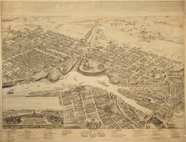
Bird’s Eye View of Canada’s Capital City of Ottawa in 1876
Map Showing How Many Years You Have To Work To Buy A Home In Canada (And US)
Toronto Subway vs Chengdu Metro 2010 – 2024
Some more facts about Canada:
1/3rd of the country was once controlled by the oldest company in North America (which has just gone bankrupt)
It has the world’s largest Electoral District (8 Times Larger Than The UK)
50% of Canadians Live South of this Red Line
It’s the home to London International Airport
It was home to the world’s largest free standing structure for 32 years
Has one of the youngest skylines in North American.
It held a forgotten Prohibition Plebiscite of 1898 (click to find out why it was never implemented)
Random Canada product of the day:
Maps From Friday:
For more maps, you can also follow me here:
Facebook:
YouTube:
Threads:
Twitter/X:
BlueSky:
Pinterest:
Flipboard:
Instagram:


